Millions of people from the Midwest to the mid-Atlantic are under winter weather alerts as a powerful and dangerous winter storm sweeps to the east, impacting cities like Washington, D.C., Baltimore, Richmond, Virginia and Philadelphia.
The first major winter storm of the year that stretched across the U.S. is continuing on its deadly journey to the east, where cities in the mid-Atlantic, like Washington, D.C., and Baltimore, experience significant impacts from heavy snow and ice.
WINTER STORM LIVE TRACKER: SNOWFALL MAPS, CURRENT ALERTS, POWER OUTAGE FORECASTS
The storm began its journey across the nation after slamming the West Coast, where it spawned the first tornado of the year in California.
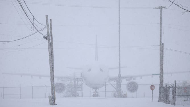
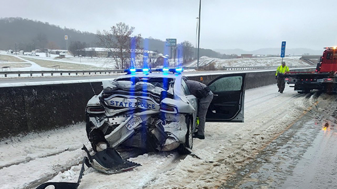
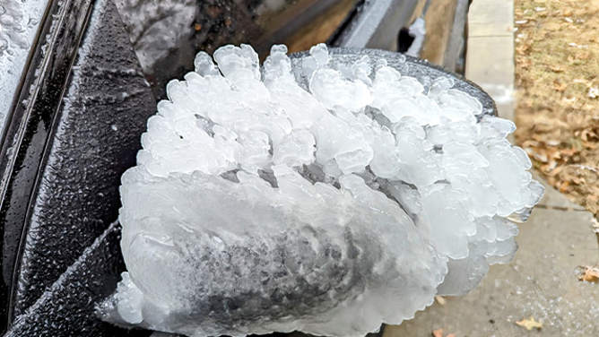
The winter weather then moved into the Plains and Midwest over the weekend, where blizzard conditions were experienced at Kansas City International Airport, and sleet and freezing rain led to numerous crashes across the region from Kansas and Missouri through the Ohio Valley.
And at least one death is being attributed to the storm. According to the Missouri State Highway Patrol, a vehicle was parked on the shoulder of Interstate 29 in Mound City when the victim got out of the vehicle. Officials say the vehicle then began to slide down a hill and hit the 33-year-old victim from Neligh, Nebraska.
Power has also been knocked out across the region. As of Monday morning, poweroutage.us reported nearly 250,000 outages across portions of Missouri, Illinois, Indiana, Kentucky and West Virginia.
Now, the storm is bringing its fury to the mid-Atlantic states, where it will cause major disruptions to travel and daily life, and also lead to widespread power outages.
SEE IT: US SMACKED WITH SNOW, ICE FROM POWERFUL COAST-TO-COAST WINTER STORM
Washington declares snow emergency, Maryland under state of emergency

(FOX Weather)
In advance of the storm, governors in several states, including Maryland, declared a state of emergency and warned residents to stay home if possible to ensure safety due to the treacherous driving conditions on roads and highways across the region.
“Keeping Marylanders safe is our top priority. Please stay off the roads during this storm. Prepare your home and family and charge your communications devices in case you lose power,” Maryland Gov. Wes Moore said in a statement. “I signed an executive order declaring a State of Emergency and have directed the Maryland Department of Emergency Management to coordinate response with the Maryland Department of Transportation, State Police, and all State agencies.”
A winter storm warning issued in Staunton, Virginia as snow conditions continue on highway 81.
Moore said the state would also be closed on Monday.
Washington D.C. Mayor Muriel Bowser was also taking steps to prepare and declared a snow emergency through at least the end of the day on Tuesday. With that declaration, vehicles were ordered not to park on snow emergency routes, and the pre-treatment of roads was set to begin on Sunday night.
Washington, D.C., schools were also closed on Monday due to the impending major winter storm.
DOWNLOAD THE FREE FOX WEATHER APP
Winter storm leads to treacherous travel on roads, major airports also impacted
Video shows ice accumulating on the windshield amid heavy snow conditions on the road.
Officials have been warning residents across the nation, from the Midwest to the mid-Atlantic, to stay off the roads if possible.
The Maryland Department of Transportation urged drivers to keep speeds low if travel is needed and to not crowd DOT crews who have been busy pre-treating roads since Sunday.
The Virginia Department of Transportation said road conditions began to deteriorate on Sunday and were expected to worsen overnight into Monday.
“The intensity of the storm will produce conditions that will require multiday operations to make roadways passable, which means travelers will not immediately see bare pavement,” the Virginia DOT warned in a statement. “Snow removal operations will take time, and safety for crews and the traveling public is paramount.”
DRIVING ON THE ICE AND DRIVING IN THE SNOW: WEATHER DRIVING TIPS FOR DRIVING IN INCLEMENT WEATHER
FOX Weather Meteorologist Kendall Smith was reporting live from Kansas City, Missouri, when a bright flash of lightning illuminated the sky and loud thunder rumbled across the region.
As of Monday morning, the dangerous winter storm was also wreaking havoc on major airports in the Washington and Baltimore areas.
According to flightaware.com, more than 400 cancellations have already been reported at Ronald Reagan Washington National Airport (DCA), and more than 200 have been reported at Baltimore/Washington International Thurgood Marshall Airport (BWI).
Those numbers are only expected to rise throughout the day as the storm continues its onslaught on the region, and that could have a ripple effect and impact flights across the nation.
More than 61 million under winter weather alerts from the Midwest to mid-Atlantic

(FOX Weather)
Winter Storm Warnings stretch across the U.S. from the Midwest to the mid-Atlantic and include major cities like St. Louis, Indianapolis, Baltimore and Washington. A Winter Weather Advisory is in effect for Philadelphia.
The FOX Forecast Center said the storm is expected to pound the mid-Atlantic states throughout the day and wind down later on Monday night. The heaviest snow is expected from the central Appalachians through the Washington, D.C., and Baltimore metros, as well as Delaware.
Within the snowfall area, the FOX Forecast Center said a narrow but intense strip of very heavy snow, with snowfall rates approaching 1-2 inches an hour, is expected.

(FOX Weather)
Within that band, travel will be extremely dangerous, if not impossible. Snowfall totals in the double-digits are expected.
The heaviest snow will impact Washington and Baltimore through the afternoon, and as the main area of snow slides offshore, a secondary area of snow will pivot back to the Appalachians and mid-Atlantic into the overnight hours.

(FOX Weather)
Moderate to heavy snow, likely much fluffier than what is occurring on Monday, will add a few more inches of snow before the storm winds down on Tuesday.


